TAOS™ Real Time Global Hazard Tracking System      


Last Update: Wed 16 Oct 2024 05:08:16 UTC


Click on an icon to see information on the hazard, including economic impact and link to Event Summary Page.
Exclamation point indicates an area with the significant potential for Tropical Cyclone (TC) formation.
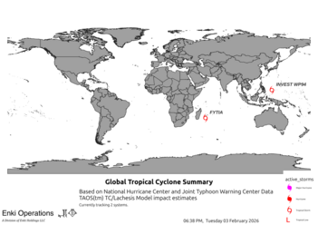
L symbol is tracked tropical low. Tropical Storm/Hurricane symbol is an active storm. Green polygons are TC hazard areas.
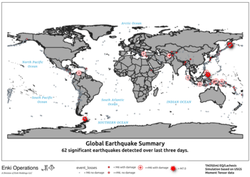
Red broken house is an earthquake with possible ground motion. Red polygons are EQ hazard areas.
Purple polygons inidicate potential for severe weather such as supercell thunderstorms and tornadoes.

Tropical Cyclones

Last ATCF check: 2024-10-16 01:05:03

Red ATCFID: updated this cycle.
ATCF ID Time Wind(kts) Location Forecast Economic Impact Details
AL942024 2024-10-16 00:00:00 25 NORTHERN MID-ATLANTIC RIDGE $ .00 Million USD Event Summmary

Earthquakes

Last USGS check: 2024-10-16 01:06:00

USGS ID Time Mag. Depth (km) PGA Location High Economic Impact Event Summary
us6000nyys 2024-10-16 04:30:26 5.2 10 0.1 KERMADEC ISLANDS REGION $ .00 Million USD Event Summary
us6000nyyl 2024-10-16 03:41:13 5.2 10 0.1 MARIANA ISLANDS REGION $ .00 Million USD Event Summary
us6000nyxu 2024-10-15 23:49:37 5.2 10 0.1 OFF COAST OF JALISCO, MEXICO $ .00 Million USD Event Summary
us6000nywy 2024-10-15 20:40:34 5.3 10 0.1 D'ENTRECASTEAUX ISLANDS REGION $ .00 Million USD Event Summary
us6000nyhx 2024-10-13 22:48:35 5.5 10 0.2 SOUTHEAST OF EASTER ISLAND $ .00 Million USD Event Summary
us6000nye7 2024-10-13 06:15:26 5.1 10 0.1 SOUTHEAST OF EASTER ISLAND $ .00 Million USD Event Summary

Report generated by cortex2.methaz.org at Wed 16 Oct 2024 05:08:16 UTC
Copyright(c) 2024 Enki Holdings, LLC. All Rights Reserved.